Shaam Adam Shaam Adam
.

Hi, I'm Shaam Adam — GIS Specialist

About & Resume

My name is Shaam Adam and I am a GIS Specialist with U-Spatial at the University of Minnesota. I earned a Bachelor of Science in Geography with a minor in Geographic Information Science in 2023. I am currently working on my Masters of Geographic Information Science with a minor in Systems & Industrial Engineering. I am experienced in web GIS development, spatial data analysis, and Python automation (ArcPy, GeoPandas, Pandas). I build interactive web applications and dashboards to support data-driven decision-making, with recent work extending into applied AI — deploying locally-hosted LLMs for chatbot tools.

  • GIS & Spatial: ArcGIS Pro, ArcGIS Enterprise, ArcGIS Online, ArcGIS JavaScript SDK
  • Python (ArcPy, Pandas, GeoPandas), SQL (PostgreSQL/PostGIS), R
  • Web Development: JavaScript, HTML, Arcade, Vite/npm
  • Applied AI: RAG-based LLM applications, Azure AI Foundry, LiteLLM

Technical Skills

My Resume
ArcGIS Pro
ArcGIS Online
ArcGIS Enterprise
ArcGIS JavaScript SDK
Python
ArcPy
Pandas
RAG-based LLM applications
SQL

Projects

Global Carbon Challenge Carbon
Web App Geoprocessing Tool Python

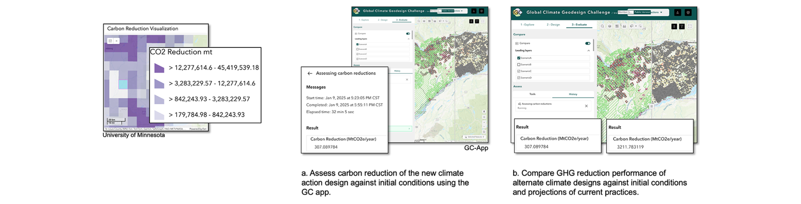
Carbon Assessment Tool

Developed automated geoprocessing tool for carbon sequestration analysis using 1 km grid overlays. Integrated custom tool into Experience Builder web application enabling real-time spatial analysis for environmental decision-making. (Private client project)

ArcGIS Pro Python ArcPy ArcGIS Enterprise ArcGIS Experience Builder
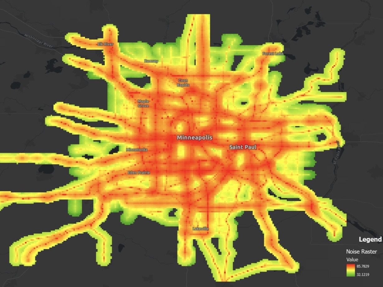
Twin Cities Noise Grid
PostgreSQL PostGIS

Twin Cities Noise Pollution Model

A PostGIS-based noise pollution propagation model for the Twin Cities metro area replicating European noise mapping standards for the Twin Cities. This project models combined transportation noise exposure from roads, rail, and airports across 2,380 schools and 817 census tracts. A custom distance decay function built in PostgreSQL calculates estimated noise levels at each receiver location, flagging sites that exceed the WHO 65 dB threshold for significant noise impact.

PostgreSql PostGIS Spatial Analysis
World Terrestrial Ecosystems
Javascript Web Application

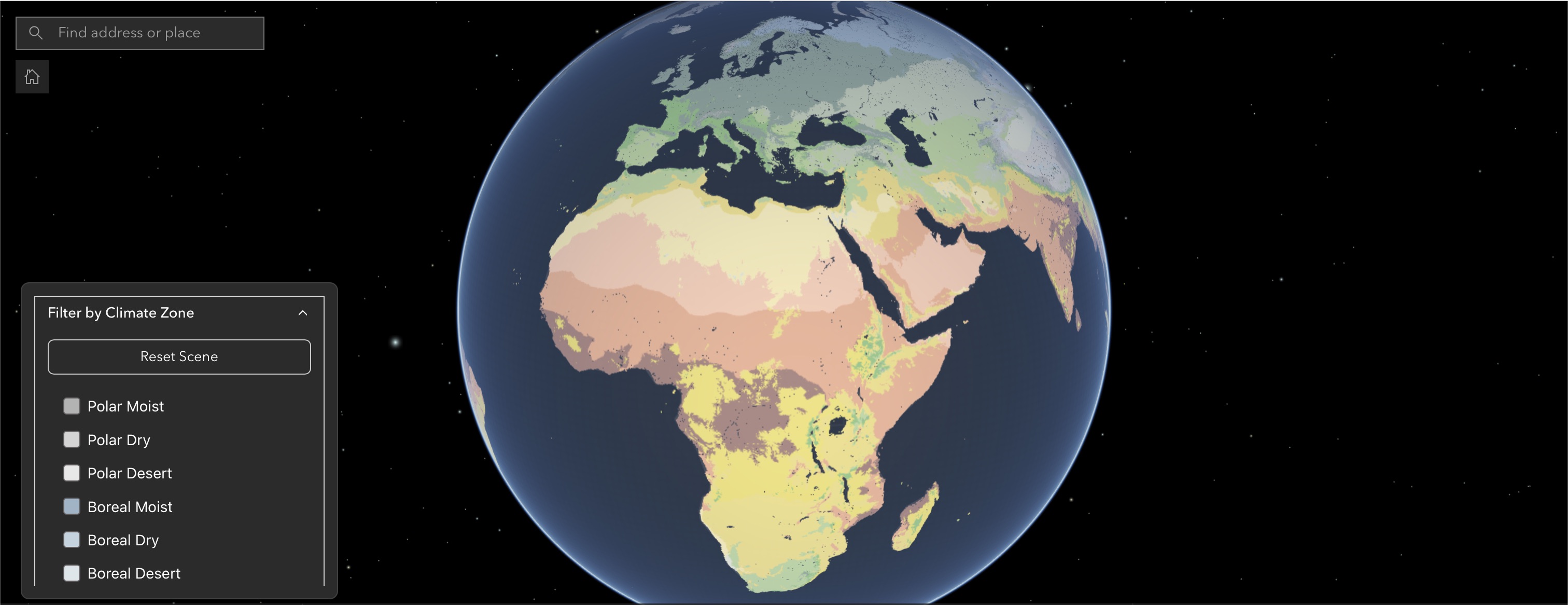
World Terrestrial Ecosystems

Explores how communities across the globe are connected in novel and unexpected ways. Developed using the ESRI Javascript SDK. (codebase private)

ArcGIS Pro ArcGIS Enterprise ArcGIS Javascript SDK
UMN Centers and Institutes Map showing of the connections across the UMN
ArcGIS Knowledge ArcGIS Pro

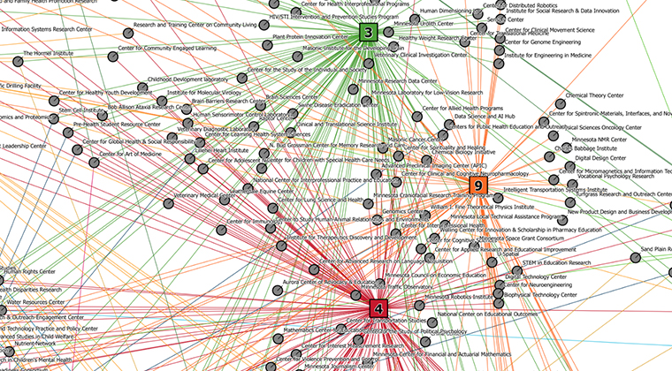
ArcGIS Knowledge Map of UMN Centers

Created an ArcGIS Knowledge Link Chart that illustrates how the UMN research community is connected by shared interests aligned with the United Nations Sustainable Development Goals. The goal is to increase collaboration between UMN Centers.

ArcGIS Pro ArcGIS Enterprise ArcGIS Knowledge
mapping climate inequities in the Twin Cities
Python Spatial Data Science ArcGIS Pro

Spatial Analysis - Twin Cities Climate Inequality Analysis

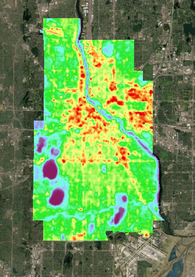
Project on mapping climate inequities in the Twin Cities. Focus on urban heat and how it disproportionately affects low-income and minority communities, focusing on limited tree cover, impervious surfaces, and older buildings. Explored how surface temperature and vegetation vary across socioeconomic groups. The analysis combined imagery that derived surface temperature and NDVI with demographic data from the US Census. Automated the workflow and outcome included maps and charts.

ArcGIS Pro Python ArcPy